Airports
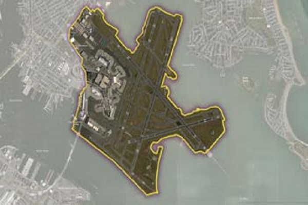
The Airports dataset delineates the geographic boundaries of public and private airport facilities. Individual airport boundaries include associated terminals, hangars, maintenance and outbuildings as well as, runways, tarmacs, helipads, parking areas, and satellite parking lots.
Airports is primarily based on authoritative data feeds from the Federal Aviation Administration (FAA) including data from the National Flight Data Center (NFDC). We continually review these and other sources to maintain and update the airport boundary currency and representation.
Benefits
- Understand proximity to airports
- Gain the market insights needed to support real estate selection, valuation, and analysis
- Target travelers effectively
- Create geofences and identify consumers who travel
- Develop location-based marketing campaigns that can push relevant messages to mobile devices and trigger real-time deals exactly when a flight lands
- Add context to any map display
Details
- Incorporates over 4,770 airport polygons in the United States
- Includes IATA and ICAO codes
- Provides enplanement data
Features
- Customs flag and use-type attribution
- IATA, ICAO and FAA codes
- Change table detailing adds/deletes/changes from last release
- Quarterly updates detailing where changes and coverage expansion have occurred
ooioioiiiooioioiioiiooioiiiooiooiiioioioiiiooioioii
Specifications
Coverage
United States
Release schedule
Quarterly
Unit of sale
Country