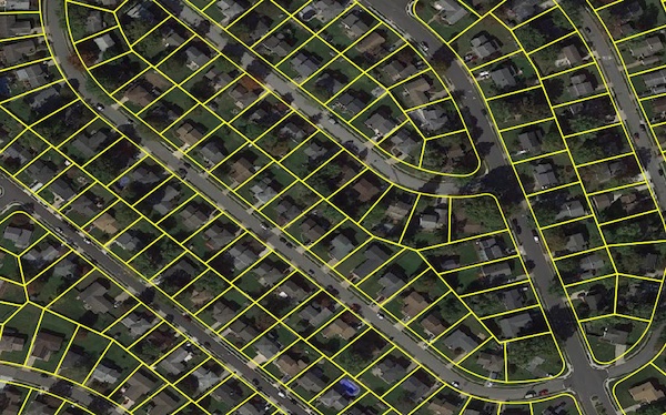
Parcel Boundaries
Parcel boundary data helps users map and analyze property characteristics across an entire area of interest, or conduct sophisticated spatial analysis such as proximity, overlay, and buffer zone operations. Parcel Boundaries contains polygonal property outlines. Features within the dataset, such as the PreciselyID and Assessor Parcel Numbers, enable interoperability with property attributes, building footprints, U.S. Census Bureau data, and address genealogy.
Parcel Boundaries is one of the property data enrichment products that work with Property Graph.
Learn more about how you can benefit from having a comprehensive view of a property.
Is Parcel Boundaries right for you?
Answer a few quick questions about your business and your intended use so we can help you determine if the data is a good fit for your use case.
Benefits
- Identify property location, centroids and boundaries, for display and spatial analysis
- Quantify risks associated with flood, wildfire, or other hazards to accurately price insurance policies
- Link Parcel Boundaries to World Points of Interest, Property Attribute Assessments, and Buildings for improved location intelligence
- Use geofencing to identify when service vehicles are on the property where services are requested, or when customers are within certain areas for location-based messaging
- Assess damages after catastrophic events by overlaying parcel data on satellite imagery
- Locate retail and site properties for sale and learn more about surrounding geographies
- Improve the accuracy of tax jurisdiction assignments.
- Respond to outages more efficiently by defining which customers are serviced by a grid
- Identify properties for retail locations and popup services
Details
Parcel Boundaries provide polygons with the following attribution:
- Unique parcel identifier
- FIPS and APN
- Census codes for state, county, tract, block group, and block
- Centroid elevation in feet
- Centroid latitude and longitude
- Property primary base street address
- Property unit number
- Property city
- Property state
- Property postal code
Features
- Unique parcel identifiers assigned to every feature
- PreciselyID, a unique and persistent identifier for every known address
- Links to a full array of property attributes
- Contains full property address for applicable parcels
- Provides U.S. Census Bureau block ID for reference to full census information
- Includes standardized and cleansed county assessor parcel numbers
- Quarterly updates include new county additions, existing parcel updates, and address changes
ooioioiiiooioioiioiiooioiiiooiooiiioioioiiiooioioii
