Historical Weather Risk
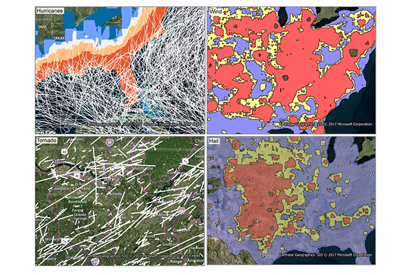
Historical Weather Risk contains comprehensive historical records of hazardous weather data including hurricane, hail, tornado, and windstorm events. Each weather hazard contains attribution about the date and the severity of the event.
- Wind events use the Beaufort Wind scale
- Tornadoes use the Fujita-Pearson scale
- Hail events use the TORRO intensity scale
- Hurricane events reference the Saffir-Simpson scale
Additional attribution including magnitudes, fatalities, injuries, crop/property damages, and other meteorological details are provided as available.
Benefits
- Assess average weather risk exposure while writing new business
- Calculate probable maximum loss with respect to the geographic distribution of their insured network
- Add detailed context for calculating policy holder premiums and minimizing exposure
- Understand the historical tornado, hail, wind, and/or hurricane severity for a given location
- Determine the aggregate weather risk of any geographic region
- Understand historical counts and averages at the property level
Features
- Contains historical records of tornadoes, windstorms, hailstorms, and hurricanes from 1995 – present
- Includes a grid that aggregates the counts and intensity of historical weather events across the U.S. to easily understand frequency of events
- Each type of weather hazard contains a qualitative rating system derived from quantitative facts to easily compare severities across regions
- Provides ranges or contours of qualitative ratings to further identify risk distributions
- Includes a geo-enrichment file which appends historical weather risk information to every affected address location using a unique identifier
ooioioiiiooioioiioiiooioiiiooiooiiioioioiiiooioioii
Specifications
Coverage
United States
Release schedule
Quarterly, Annually
Unit of sale
Country