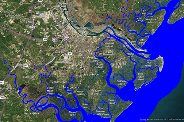
Coastal Risk
Coastal Risk contains information pertinent to shorelines and coastal areas subject to hurricanes, storm surge, flooding, and other natural disasters. This dataset depicts the shape of the shoreline, name of the coastal water, and proximity to the nearest coastline.
Benefits
- Identify assets within close proximity to shorelines to understand risk exposure related to storm surge, tsunami, and low lying areas especially prone to flooding
- Streamline underwriting workflows and price new business for profit
Details
- Features a polyline representation of shorelines across the globe
- Provides a polygonal representation of U.S. coastal areas
- Includes a geo-enriched address file
Features
- NOAA Medium Resolution Digital Vector Coastline provides the coastline of the contiguous US
- Data is captured from 270 National Ocean Service (NOS) Navigation Charts and spans more than 80,000 nautical miles
- Includes a geo-eriched address file which appends coastal risk information to every affected address location using a unique identifier
- Proximity measurements are also included for added insight at the address level
ooioioiiiooioioiioiiooioiiiooiooiiioioioiiiooioioii
Specifications
Coverage
United States
Release schedule
Annually
Unit of sale
Country